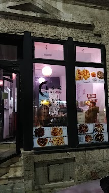
Restaurant nearby Pizzeria
Serbia
Restaurant nearby Pizzeria
Pizzeria
Kraljice Marije, Beograd, Grad Beograd, RS Serbia
contacts phone
:
+381
Latitude:
44.8068572
, Longitude:
20.4778478
larger map & directions
read more
nearest Restaurant
70 m
ФФГ Кетеринг
Ivankovačka 6, Beograd
Restaurant
read more
148 m
yi xiang ju 溢香居
Ruzveltova 13, Beograd
Restaurant
read more
158 m
Fast food Vajonera
Ruzveltova 1, Beograd
Restaurant
read more
166 m
Giros Mr. Pomfrit restoran
Ruzveltova 17, Beograd
Restaurant
read more
172 m
Dal Metfu
3 KRALJICE MARIJE, 11060, Belgrade (Palilula), Belgrade county
Restaurant
read more
182 m
Chicken King's
Ruzveltova 14, Beograd
Restaurant
read more
257 m
TRPEZARIJA - Salad Bar
Miročka 6, Beograd
Restaurant
read more
283 m
Lajavi Krelac
2A VLADETINA, 11060, Belgrade (Palilula), Belgrade county
Restaurant
read more
299 m
Jolly Roger Pub
Kraljice Marije 1, Beograd
Restaurant
read more
310 m
Soya sos
Bulevar kralja Aleksandra 116, Beograd
Restaurant
read more
376 m
Орашац
RS, 11000, Bulevar kralja Aleksandra 122, Beograd
Restaurant
read more
394 m
Кафана Ходач
Dimitrija Tucovića, Beograd
Restaurant
read more
395 m
Piccolo Ristorante
Ruzveltova 33, Beograd
Restaurant
read more
405 m
北京Lee
Dimitrija Tucovića, Beograd
Restaurant
read more
436 m
Pizzeria Rafaelo
Kičevska 9, Beograd
Restaurant
read more
473 m
Bang Bang Food & Coffee
Kicevska 20, Beograd
Restaurant
read more
473 m
Kod Pribojca
Sinđelićeva 10, Beograd
Restaurant
read more
504 m
Излог
Dvadeset sedmog marta 29, Beograd
Restaurant
read more
552 m
Index Bite
64 MOLEROVA, 11104, Belgrade (Vracar), Belgrade county
Restaurant
read more
573 m
Zapata
Vojvode Bogdana 13, Beograd
Restaurant
read more
586 m
Pile & Prase
Булевар краља Александра 114, Београд
Restaurant
read more
614 m
Kalenic
Mileševska 2, Beograd
Restaurant
read more
651 m
Ćevapaj
39,, Kursulina, Beograd
Restaurant
read more
692 m
Mileshevski Fenjer D.O.O.
Mileševska 16, Beograd
Restaurant
read more
722 m
Café Privé
Njegoševa 63, Beograd
Restaurant
read more
📑
all categories
Accounting
Administrative area level 2
Airport
Amusement park
Aquarium
Art gallery
Atm
Bakery
Bank
Bar
Beauty salon
Bicycle store
Book store
Bowling alley
Bus station
Cafe
Campground
Car dealer
Car rental
Car repair
Car wash
Casino
Cemetery
Church
City hall
Clothing store
Colloquial area
Convenience store
Courthouse
Dentist
Department store
Doctor
Electrician
Electronics store
Embassy
Establishment
Finance
Fire station
Florist
Food
Funeral home
Furniture store
Gas station
General contractor
Grocery or supermarket
Gym
Hair care
Hardware store
Health
Home goods store
Hospital
Insurance agency
Jewelry store
Laundry
Lawyer
Library
Light rail station
Liquor store
Local government office
Locality
Locksmith
Lodging
Meal delivery
Meal takeaway
Mosque
Movie rental
Movie theater
Moving company
Museum
Natural feature
Neighborhood
Night club
Painter
Park
Parking
Pet store
Pharmacy
Physiotherapist
Plumber
Point of interest
Police
Post office
Premise
Real estate agency
Restaurant
Roofing contractor
Rv park, camping
School
Shoe store
Shopping mall
Spa
Stadium
Storage
Store
Supermarket
Synagogue
Taxi stand
Train station
Transit station
Travel agency
University
Veterinary care
Zoo
administrative area level 3
sublocality level 1
↑